Sep 2024 – Apr 2025 · ROS 2 · Jetson Orin NX · Team lead
Frontier-Based Autonomous Exploration Vehicle
Led a team to develop an autonomous exploration system using ROS2 and LiDAR. Implemented SLAM algorithms including Cartographer and Navigation2 for real-time mapping and path planning. Integrated YOLOv11 for object detection and deployed the complete system on embedded hardware.
Demo
Overview
An autonomous rescue robot designed to explore unknown indoor environments and mark the locations of injured persons. The robot autonomously navigates, builds a map in real time, and detects casualties along the way.
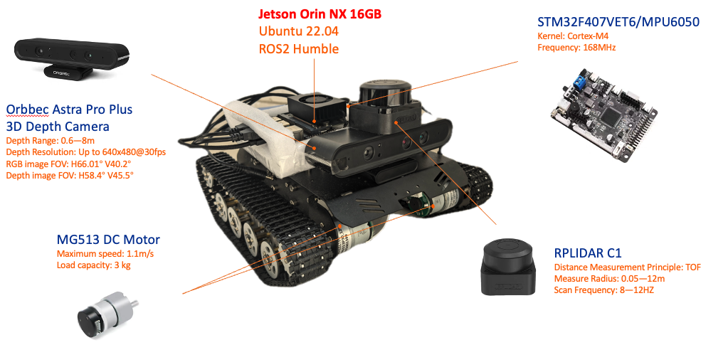
Hardware
- Jetson Orin NX 16GB — onboard compute (Ubuntu 22.04, ROS2 Humble)
- RPLIDAR C1 — 2D LiDAR for SLAM and mapping
- Orbbec Astra Pro Plus — 3D depth camera for YOLO-based casualty detection
- STM32F407VET6 / MPU6050 — motor control and IMU
- MG513 DC Motors — differential drive
Software Stack
- Cartographer — real-time SLAM (mapping and localization)
- Navigation2 — point-to-point autonomous navigation
- YOLOv11 — casualty detection via depth camera
Key Contribution: Information-Gain Frontier Exploration
Standard frontier exploration creates redundant paths. We formulate an optimized frontier selection that balances new information against travel cost:
\[f^* = \arg\max_{f \in F} \left( w_1 \cdot I_f - w_2 \cdot D_f \right)\]where \(I_f\) is the information gain of frontier \(f\) and \(D_f\) is the navigation cost. The robot selects the frontier that maximizes expected coverage while minimizing unnecessary travel.